Distance: 23miles (37km) Ascent/Descent: 590m/520m
Start/Finish: Luskentyre Beach to Ardvoulie
Terrain: 20% road, 60% Good path, 20% Swampy path
Transport: Bus Services for both start/end
Route: Route Map | Garmin Course
Summary
I can't understand why such a great official walking route receives such little promotion! I had never heard of the "Harris Walkway" until browsing through tourist brochures in the Hotel at Tarbert. Even the brochure offered a mere hint as to its existence - a set of straight dotted lines across a map of Harris, accompanied by just a paragraph with little clue as to what the actual route involved. So I got myself online and started searching the internet expecting to find dedicated pages about this "walkway" which was opened in 2001 by Cameron McNeish, but all I found was other walkers' exclamations at the lack of information available, along with sparse accounts and a couple of photographs.
Admittedly, on inspection of an OS map of Harris, and given the start and end points (Ardvoulie to the N of Tarbert and Selibost to the SW), the route any road-avoiding explorer would choose is fairly obvious. A series of old tracks cut through the hills of Harris, and the Harris Walkway basically links them together, with just a little bit of road walking in between.
Some work has gone into this walkway - sections are marked with a plaque at either end (many now faded), giving a brief description in English and Gaelic. Also every section has at least one strategically placed bench providing a fine place for lunch or a breather.
The excellent Hebrides Transport bus services visit both start/end points. I based myself in Tarbert (ferry from Uig, Skye), and in the morning took the bus down to Luskentyre, ran from there back to Tarbert, then at 4pm took a bus N to Ardvoulie and again ran back to Tarbert. It would make a pleasant, unstressful two-day end-to-end backpacking trip with plenty idyllic camping spots to choose from.
Blog
After cycle-touring slowly up the Uists from Barra during a stormy week, negotiating cancelled ferries and dangerous side-gusts, it made a nice change to wake up to a cloudless blue sky in Tarbert. Swapping bike shoes for trail-running shoes, I boarded a bus for Luskentyre, back over the rocky pass I'd pedalled over a couple days earlier, and the driver knew exactly where to drop me off to start the coast-to-coast first section of the Harris Walkway along the "Coffin Road". Some steps up from the road lead to a style (title photograph), and I found myself on an old section of moss-covered road leading me towards the Bealach Eorabhat.
The going remained easy and it wasn't long before I was at the summit, encountering the first of many benches on this walkway. The ocean was visible to East and West.
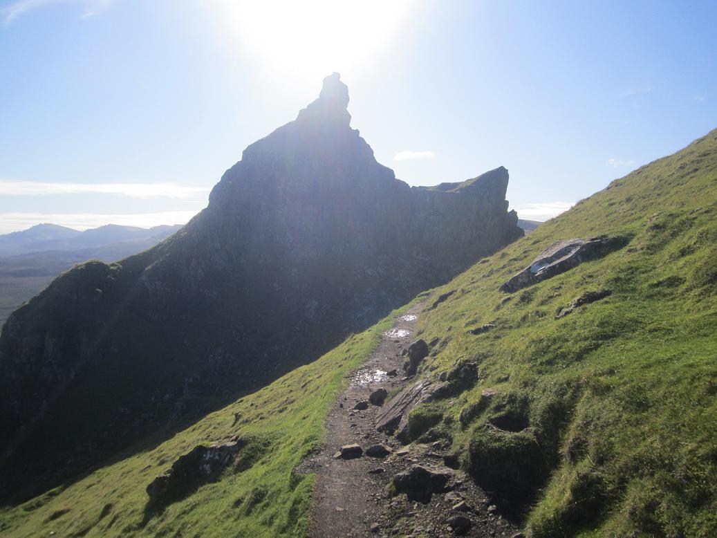
The continuation from there became much rougher, lots of leaping over bog and an occasional bit of sinking, tall marker-posts indicated the way down. After barely more than 3 miles I was on the other coast of Harris, where the route shies away from the possibility of tarmac and instead negotiates a rocky lump then meanders through one of the rockiest scenes I've seen in Scotland. Sure enough an information board declares that this area was used in Stanley Kubrick's '2001 Space Odyssey' due to its moon-like landscape.
After passing a lochan, a track joins from the right - this was my onward route, taking me down to the road junction and a plaque that described the "Coffin Road" I'd just followed.
From here at the head of Loch Stockanish, I followed the tarmac briefly uphill (ENE), until a tight left bend where a small gate (on the right) offers a route of escape back onto open hillside. A path is shown on the map from here, even though there isn't much evidence of one at first. Shortly I was once again encountering occasional way-marker posts and there became evidence of a seemingly old, well-engineered track, which these days resembles a carpet of marshy grass rolled upon the rocky terrain.
There was always a nice view over the complex coastline to the sea, and the hazy outline of Skye's Trotternish Peninsula was visible beyond. The route meets what's presumably an ancient T-junction, and after a quick consultation of the map I turned left to run initially steep uphill then attaining an impressive section of "carpet through the rocks".
It snakes down past a couple of lochans eventually arriving at a tiny place called Greosabhagh, and here a short but enjoyable bit of road-running begins. I never saw a vehicle on the 1.5 miles of road which took me to the start of the next section of old trail, with nice views of the Clisham Hills of North Harris opening up.

Another brief section of tarmac took me through Meavaig, just after which I spied the next little "plaque" on the right-hand side of the road, where a vague track skirts down the verge towards a very modern-looking wooden bridge. Again this is a section of "old road to Tarbert". The all-too-familiar dark clouds were back in the sky by this point, and so the rain was soon coming down to make sure I got soaked before I reached Tarbert. There's a final section of road, and a final small loop of old-trail, before reaching the port. From start to Tarbert, I'd clocked only 15 miles, and after a pint of 80 schilling in the Hebrides Bar I was up for seeing the final 8 miles, taking advantage of the scheduled 4pm bus to Ardvoulie so I could run back to "base" in Tarbert.

It was clear the heavy showers were back to stay as the bus took me North over a soggy Clisham Pass and down towards Ardvoulie. This part of Harris is much more mountainous. I spotted the usual "plaque" at the road-side and the driver kindly let me off the bus at an unofficial stop before Ardvoulie so I didn't have so far to run back uphill on the road! Sure enough a little sign here commemorated the opening of the Harris Walkway by Cameron McNeish in 2001.

The route starts off very soggy, but green-soggy rather than brown-soggy which meant I was probably a bit cleaner by the time I got to the top of the pass it climbs. I was really enjoying the afternoon/evening light when the sun did shine, I find its always special to be in places like this for the last few hours of daylight. One of the route's benches had been blown over up here, so I lifted it back into its right place (until the next storm hammers it in a week or two's time no doubt). Its a shame to see how faded the writing on the plaques are, some even cracked in half.
The walkway rejoins the main Stornoway-Tarbert road but not for long, and soon I was descending the road down to Loch Seaforth with nice views over the water. Near the bottom of this descent, another plaque marks the start of the final section of the walkway (in the twisted order I've done them, that is) back to Tarbert.
A couple of modern wooden bridges took me over waterfalls and the route continued almost roman-like in its straightness up the hillside. As always, the gradient was gentle and the pass was relatively low. A final bench offered the option of a break beside the Lochan nan Lachasdail, before the track climbed away to meet tarmac and the final mile West to Tarbert.